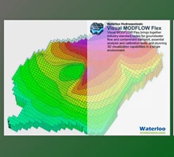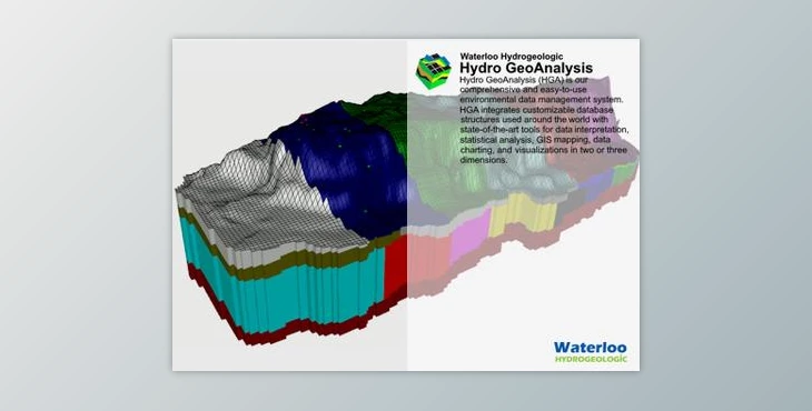
Waterloo Hydrogeologic Hydro GeoAnalyst 12.0 (Win):
Hydro GeoAnalyst (HGA) stands as an all-encompassing environmental data management system, designed for seamless integration of customizable database structures with cutting-edge tools for data interpretation, statistical analysis, GIS mapping, and multidimensional visualizations.
Our latest offering, Hydro GeoAnalyst Plus (HGA+), combines the geochemistry capabilities of AquaChem with the robust data management and extensibility features of HGA, presenting a comprehensive solution for environmental professionals.
What sets Hydro GeoAnalyst apart?
- User-Friendly Interface: Tailored for environmental professionals, geoscientists, and governmental agencies, HGA provides an intuitive interface facilitating efficient management of extensive data volumes, enabling informed decisions regarding environmental and water resource management.
- Standardized Data Quality: HGA ensures data integrity by standardizing and intelligently validating all imported data, ensuring it meets quality benchmarks necessary for reliable analyses.
- Streamlined Workflows: Kick-start projects with pre-configured environmental database templates, including tables and fields for common data types, well profiles, and report templates. Benefit from automated workflows for data collection, import, analysis, and reporting, leading to enhanced efficiency and cost savings.
- Customizable Database Structure: Unlike other solutions, HGA offers complete control over the database structure, allowing customization to meet specific project requirements and accommodate data volume scalability.
Access vital information effortlessly:
- Query Builder: Construct simple to complex data queries without SQL expertise using an intuitive interface. Define query conditions by drag-and-drop database fields, selecting logical operators (AND, OR, LIKE, IS), facilitating easy data retrieval.
- Insightful Analysis: Unlock deeper insights into environmental data with an array of integrated analysis, interpretation, and visualization tools, including Map Manager, Cross Section Editor, Well Profile, Time Series Charts, and Scene Viewer.
- Cost-Effective Solutions: Developed exclusively by Waterloo Hydrogeologic, the analysis tools bundled with Hydro GeoAnalyst guarantee interoperability, saving costs on procurement and license management.
Applications of Hydro GeoAnalyst:
- Manage groundwater monitoring networks at local, state, and federal levels.
- Analyze borehole data for mineral exploration projects.
- Maintain well construction details and registration information.
- Handle data related to remediation projects effectively.
- Store and report landfill monitoring data, groundwater vulnerability assessments, and protection planning.
- Map aquifer extents and geological formations accurately.
- Evaluate and report spatial distribution of water quality parameters comprehensively.
Download Waterloo Hydrogeologic Hydro GeoAnalyst 12.0 (Win) from the below link now!
Dear user, you must first login to your account to write your comment.
Please click here to Log in

Files Password : gfxplugin.com